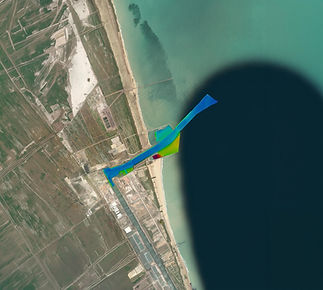
Hydrographic and Geophysical Survey
The Hydrographic and Geophysical Survey line positions TideWise at the forefront of characterizing marine environments in a 100% uncrewed manner. Operating with the first autonomous robots authorized by the Directorate of Ports and Coasts (DPC / Brazilian Navy) and the Hydrographic Center of the Navy (CHM / Brazilian Navy), we conduct surveys according to international standards (S-44 / NORMAM-501) and with a history of Category A and B bathymetry. We operate equipment from various manufacturers, with experience in integrating models manufactured by Kongsberg, Sonardyne, Nortek, Norbit, EdgeTech, Innomar, among others. TideWise's agnostic philosophy allows the integration of such sensors into proprietary robotic vehicles, performing surveys focused on mapping the seabed, subsea, and navigational hazards. Technology optimizes productivity and reduces costs in port surveys of access channels, berths, spoil heaps, and pre/post-dredging bathymetry, generating detailed XYZ clouds and GIS maps.
Our main services include:
-
Surveys using a multibeam echo sounder (Multibeam Echosounder MBES);
-
Surveys using a single-beam echo sounder (Singlebeam Echosounder SBES);
-
Side Scan Sonar (SSS) surveys;
-
Sub-bottom profiling for shallow seismic data (using Sub-Bottom Profilers - SBP);
-
Current lifting with ADCP;
-
Tide gauge surveys;
-
Surveys with CTD (Conductivity, Temperature and Depth).

Multibeam bathymetry
3D underwater mapping up to 150m deep using multibeam sonar technology. The service delivers raw data, bathymetric reports, and three-dimensional digital models.
Sub-bottom profile survey
Identifying the layers of the seabed using low-frequency acoustic pulses.
Current measurement (ADCP)
Measuring the intensity and direction of the current in the water column using an ADCP (Acoustic Doppler Current Profiler) to study current circulation.
Wave measurement
Measuring wave height, intensity, and direction for asset installation studies.
Single-beam bathymetry
Mapping of the underwater profile up to 150m deep using single-beam sonar technology.
The service delivers raw data and bathymetric reports.
Detection of submerged objects
Detection of submerged objects, up to 60m deep, through high-frequency acoustic pulses, using ROVs with side-scan sonars.
Wind measurement
Measuring wind intensity and direction for the study of wind farm installation.
Oil spill monitoring
Identifying potential oil spills using radar, drones, and artificial intelligence, and collecting samples for analysis.